
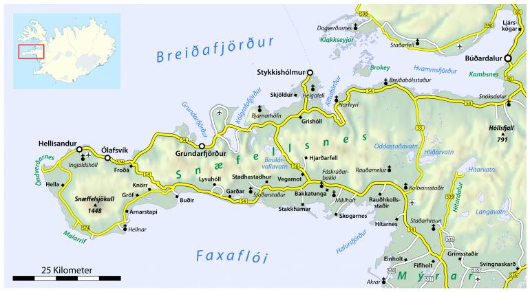
What is the Snæfellsnes Peninsula? — Iceland in Miniature
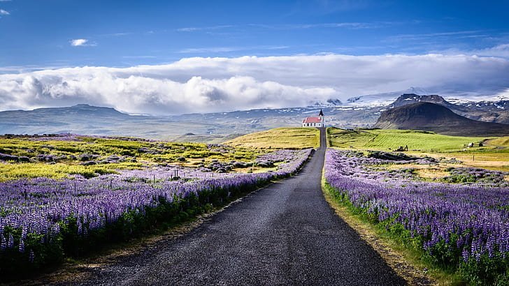
The Snæfellsnes Peninsula, located in West Iceland, has been nicknamed Iceland in Miniature due to the sheer variety of natural highlights found there.
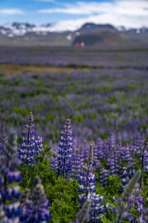
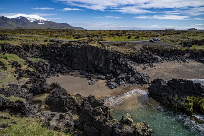
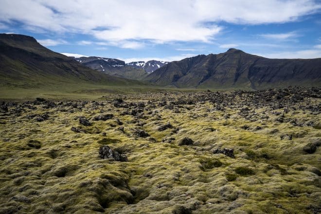
Visitors looking to experience all that makes Iceland unique are guaranteed not to leave Snæfellsnes disappointed. Waterfalls, volcanoes, glaciers, magma craters, and black sand beaches can all be found dotted around the region.
That’s not to mention the many lovely coastal towns and villages which around 4,000 people call home.
Charming coastal settlements like Stykkishólmur, Grundarfjörður and Ólafsvík all have something to offer those seeking local culture amid staggering scenery.
- Check out this range of Privately Guided Tours in Iceland
The entire peninsula can be travelled by car in a single day. However, to truly maximise the experience, guests are recommended to spend a couple of days in the area as to indulge in all Snæfellsnes offers.
These include visiting its gorgeous towns, staying overnight on the remote Flatey island, or taking part in fun-filled activities like glacier hiking or horse riding.
Without further ado, let’s take a look at all that makes Iceland’s Snæfellsnes Peninsula one of the most beautiful and unique areas in the country.
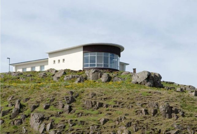
Snæfellsjökull National Park
Snæfellsjökull National Park was first established in June 2001, and covers approximately 170 square kilometres of land.
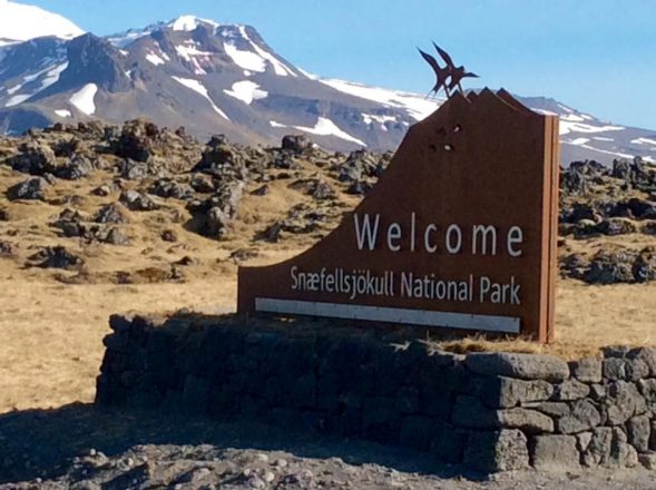
The national park was founded solely to protect the diverse flora, fauna and historical sites so prevalent in the region. As such, a number of interesting stops can be found within its boundaries, many of which will go into with more detail later in the article.
- Planning a trip to Iceland soon? Make sure. to read our feature article A Complete Guide to Visiting Iceland in Winter
Admission to the national park is free, as it is with all national parks in Iceland. During the summer months, park rangers monitor and maintain the site, and are often available to provide guests with more information.
Top Attractions on the Snæfellsnes Peninsula
As mentioned previously, the sheer variety of interesting stops on the Snæfellsnes Peninsula has made the area incredibly popular with international visitors. This is especially true for those with only a week, or a few days even, to spare in the country.
With that said, if you’re planning on paying a visit to Snæfellsnes, make sure to thoroughly research the sites below to make sure you don’t miss out on the attractions and activities that matter most to you.
Snæfellsjökull Glacier and Volcano
The national park, and indeed, the entire area, are named after the dramatic Snæfellsjökull glacier, which sits just at the end of the peninsula at a total height of 1446 metres (4744 ft).
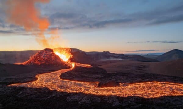
The mighty ice cap covers a volcano, which helped create Snæfellsnes’ spectacular landscapes thousands of years ago.
On clear days, the peaks of Snæfellsjökull can be seen from Reykjavík, around 120 kilometres (75 mi) away, by those looking out across Faxaflói Bay.
Over 700,000 years old in age, the subglacial volcano was first climbed in 1754. Today, the mountain is a popular stop among glacier hikers and snowmobilers.

Snæfellsjökull volcano famously served in Jules Verne’s classic science fiction novel, Journey to the Centre of Earth (1871), as the enigmous entry way to the planet’s interior.
- Don’t miss out on our selection of Summer Holiday Packages in Iceland
This was not the only time Snæfellsjökull has been of interest to science fiction enthusiasts.
On November 5th 1993, a group of travellers ascended the mountain believing that an alien landing there was imminent. Suffice to say, no little green men showed up.
That’s not to say their belief was entirely without precedent.
For centuries, Snæfellsjökull has been considered one of the world’s mythical energy sources. It is often cited as one of the places where Iceland’s elvish hidden folk (Huldufólk) call home.
Gerðuberg Basalt Cliffs
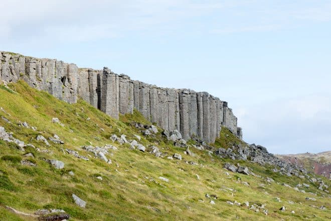
You can clearly see the Gerðuberg basalt cliffs while entering the Snæfellsnes region from West Iceland.
While not particularly high—reaching only 14 metres (46 ft)—these cliff sides stretch out wide across the landscape, making for an impressive start for those discovering this area’s scenery.
- Looking for a unique adventure? See our great Off the Beaten Path Tours in Iceland
Aside from being one of the first sights on the peninsula, the Gerðuberg cliffs are best known for their perfectly shaped hexagonal columns.
Though at first they appear sculpted by the human hand, these columns were actually formed thousands of years ago after a powerful volcanic eruption. The subsequent lava flow poured across the area in neat rivulets, but was rapidly cooled by seawater at the point where the Gerðuberg cliffs now reside.
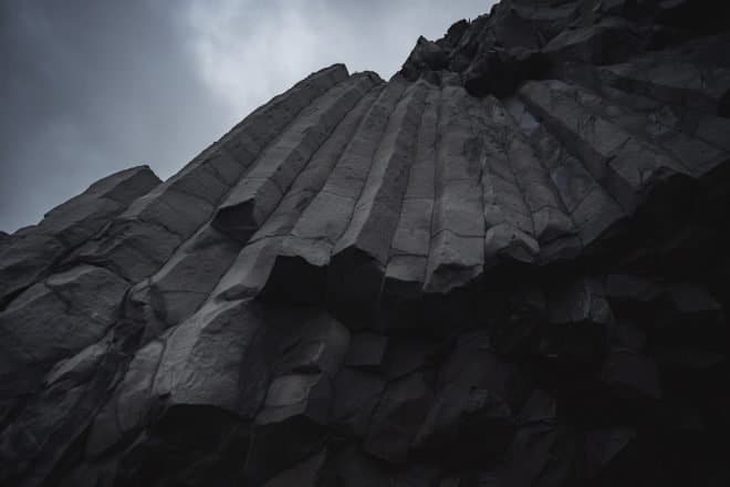
Other examples of this type of rock formation can be found at Reynisfjara black sand beach in South Iceland, and at Svartifoss waterfall in Skaftafell nature reserve.
Fairly unique to Iceland, this interesting geology was the main influence behind the peculiar architecture of Hallgrímskirkja Lutheran Church in Reykjavík.
The Gerðuberg cliffs are located roughly 122 kilometres (76 mi) from the Icelandic capital.
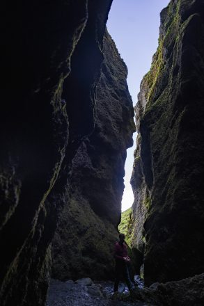
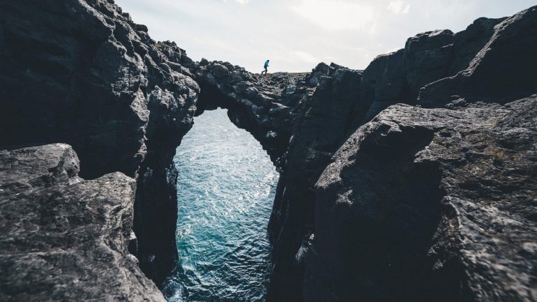
Rauðfeldsgjá Gorge
Rauðfeldsgjá (meaning Red-Cloak Rift) is a narrow ravine tucked away inside one of the many ancient cliffs that line the Snæfellsnes Peninsula. This epic natural wonder can be found right at the base of Botnsfjall Mountain, which stands at 469 metres (1538 ft).
The moss-laden walls of the canyon are glistening with damp, creating that sublime fairytale aesthetic that Iceland has become known for. Travellers who venture deep into the gorge will find a beautiful waterfall inside, similar to Gljúfrabúi waterfall on the South Coast.
The gorge was famously mentioned in the saga, Bárðar Saga Snæfellsáss. The manuscript was written approximately 600 years ago, and tells of a story that takes place in the initial years following Iceland’s settlement, around 870 CE.
According to the Saga, a local man named Bárður executed the brothers Rauðfeldur and Sölvi by throwing them into the gorge as revenge for the death of his daughter. It is from this tale that Rauðfeldsgjá takes its name.
Rauðfeldsgjá gorge is located 188 kilometres (116 mi) from Reykjavík.
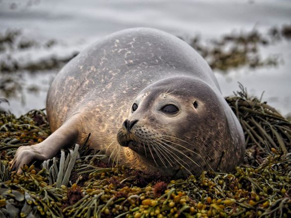
Ytri Tunga Beach
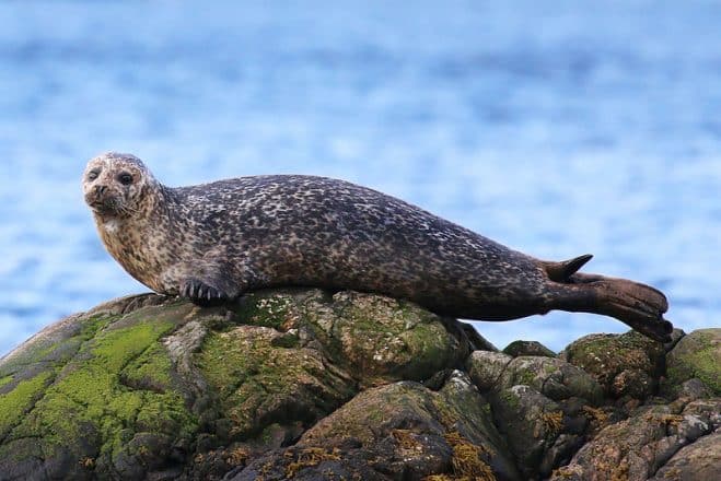
Ytri Tunga (Outer-tongue) is a large, picturesque shoreline on the south coast of the Snæfellsnes Peninsula, best known for its resident seals.
Lounging on the rocks and sands, these flippered friends make for a brilliant sight among animal-lovers, and small children will be ecstatic seeing such wild creatures up close and personal. (Note; guests are always advised to keep a minimum distance of 50 metres (164 feet) from seals in Iceland)
- Looking to experience ALL Iceland has to offer? Then check this 10-Day Ring Road Road Trip | Self-Drive Tour of Golden Circle, South Iceland, Lake Myvatn & Snæfellsnes Peninsula
The best time to see seals at Ytri Tunga beach is during the summer. The two most common species found here are Grey seals and Harbour seals (or Common seals), though others like Hooded seals and Ringed seals can sometimes be seen.
Unfortunately, some visitors expect to see Walrus, but they are no longer seen with any reliability in Icelandic coastal waters (—with the exception of the Westfjords, where they are witnessed on very, very rare occasions.)
Other reliable locations to see seals in Iceland include Jökulsárlón glacier lagoon, Hvítanes headland, and the shorelines of the Vatnsnes Peninsula.
Those travelling further North, can learn more about these fascinating creatures at the Icelandic Seal Center in Hvammstangi town, roughly 204 kilometres from Ytri Tunga in West Iceland.
There is another novelty to this site. Unlike most beaches in Iceland, which are famous for their jet-black volcanic pebbles, the sand at Ytri Tunga is a golden yellow colour.
Ytri Tunga beach takes its name from a historic farmstead that sits just on its borders. It can be found approximately 159 kilometres (99 mi) from Reykjavík.
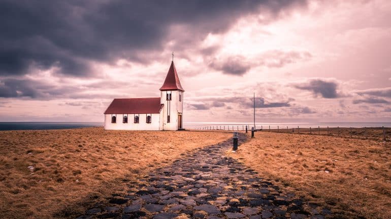
Búðakirkja Black Church
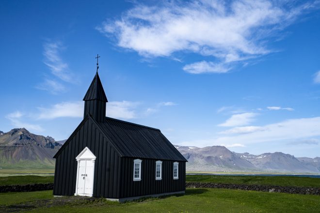
Búðakirkja is a black church that sits as part of the tiny hamlet of Búðir on the Snæfellsnes Peninsula.
Over the last decade, this holy structure has become one of the most widely photographed icons in the region. Modest, historic and somewhat spooky, the church sits surrounded by the moss-laden Búðahraun lava field, making it the perfect subject for passing shutterbugs.
In 1703, locals decided on this site on the south coast for the construction of a new church. Unfortunately, this structure was later torn down due to a lack of parishioners. The current house of worship was rebuilt in 1987 after a single member of the church doggedly lobbied for its construction.
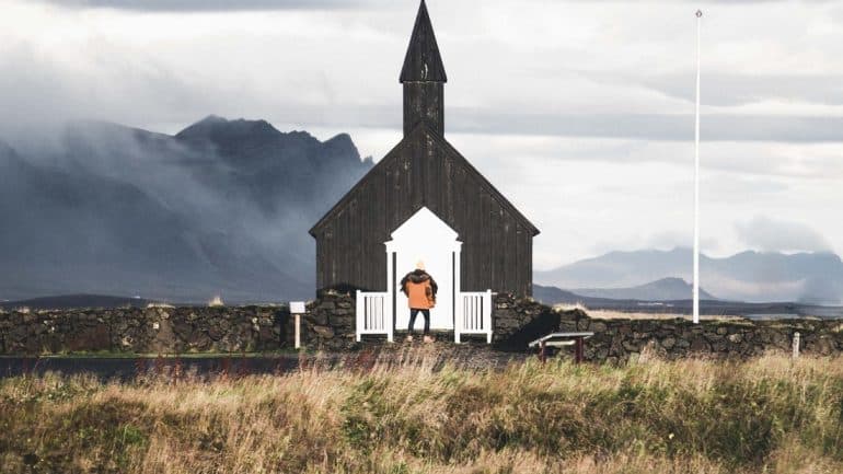
Visitors to Búðakirkja will not only appreciate the church’s black paint job, but also its eerie graveyard, and historic relics, including an old bell and decorative chalice.
The church is located approximately 177 kilometres(110 mi) from Iceland’s capital city.
Vatnshellir Cave
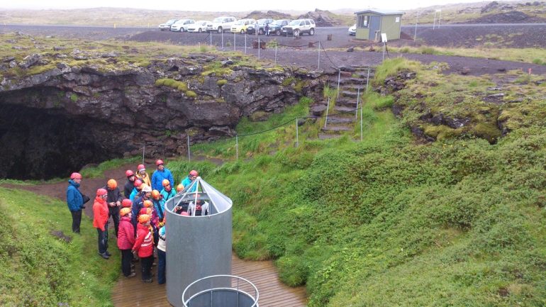
Vatnshellir (Water Cave) was first opened to the public in 2011. Nearly ten years later, participating on a guided tour inside this fascinating, subterranean cavern is one of the Snæfellsnes Peninsula’s most popular activities.
Professional and certified caving guides lead guests down a winding spiral staircase, at the bottom of which lies an impressive, 8000-year-old lava tunnel.
Before venturing inside, all visitors will be readily equipped with a helmet and headlamp. At some point during your trip, you will be asked to extinguish all light, so as to appreciate the sheer darkness of the cavern.
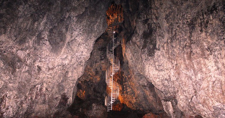
At an incredible 35 metres (115 ft) beneath the earth’s surface, guests will follow the hollowed-out chambers of an ancient lava flow. This mesmerizing tunnel extends 200 metres (656 ft), boasting vibrant red walls and strange rock formations throughout.
Vatnshellir Cave is around 201 kilometres (130 mi) from Reykjavík, and approximately ten minutes drive from the small village of Hellnar.
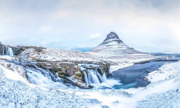
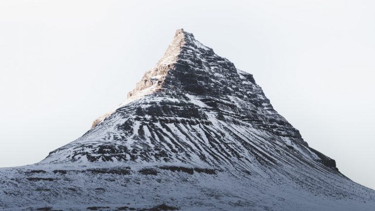
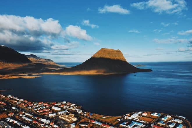
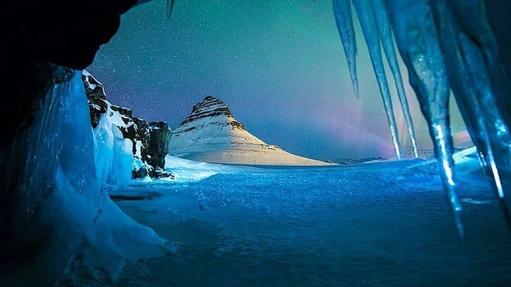
Kirkjufell Mountain
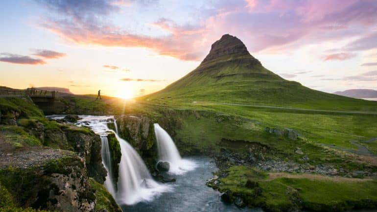
The always-stunning Kirkjufell (Church Mountain) is often cited by information providers as Iceland’s most photographed mountain.
Given the mountain’s dramatic cone slopes, pointed peak and towering dominance over nearby Grundarfjörður town, it’s easy to see why it has become a staple attraction amongst sightseers travelling the Peninsula.
The mountain reaches a total height of 463 metres (1519 ft), and juts somewhat awkwardly out into the ocean. Because of its size and location, Kirkjufell was historically used by fishermen as a sign they were approaching land.
Kirkjufell was famously showcased in HBO’s popular fantasy series, Game of Thrones, as the ‘mountain like an arrowhead’. The landmark is mentioned as part of a dream the Hound has, where he witnesses an army of the dead marching by.
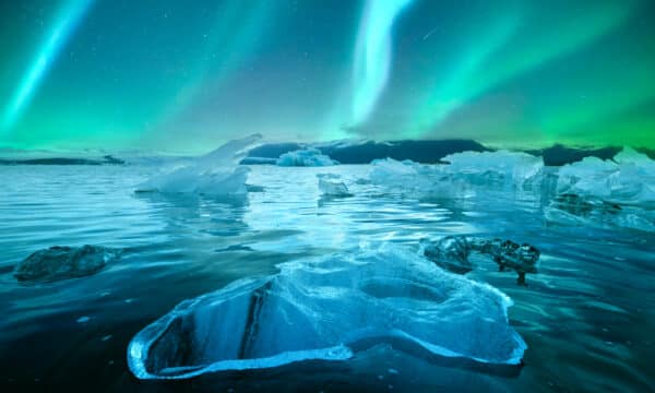
In reality, Kirkjufell is a much more tranquil setting, with the lapping waves of the Atlantic on one side and the picturesque waterfall, Kirkjufoss, on the other. All of this creates a perfect setting for photographers, especially those looking to capture the elusive Northern Lights in the winter.
- Learn more about the Aurora Borealis in our feature article The Best Places to See the Northern Lights in Iceland & Other Helpful Hints
It is possible to hike up Kirkjufell, but be warned; the footpath is incredibly narrow, and the slopes are very steep. On some parts of the ascent, there are even ropes installed to make climbing to the top easier.
Given these facts, attempting to reach the top of Kirkjufell should only ever be undertaken by fit and experienced hikers.
Kirkjufell is approximately 185 kilometres (115 miles) from Reykjavík.
Skarðsvík Golden Beach
Like Ytri Tunga, Skarðsvík is another beach on the Snæfellsnes Peninsula that boasts gorgeous golden sands.
While not exactly tropical, there is a certain Mediterrean ambience at Skarðsvík, putting one in mind of the shorelines of Spain or southern France.
Not mentioning its beauty, perhaps the most significant reason to visit Skarðsvík is to solidify to yourself just how varied Iceland’s landscapes can be.
Interestingly enough, an information board on site reveals that a Viking grave was uncovered here in 1962. Dating from the 10th century, archeologists discovered a well-preserved skeleton (a young male, aged 18 – 25), as well as a collection of his belongings. These artifacts can now be viewed among other exhibitions at the National Museum of Iceland.
Be aware, the waves at Skarðsvík are known for being unpredictable, often reaching high up the shore. Visitors should always make sure to keep well back from the waterline so as to remain safe.
Skarðsvík is located approximately 210 kilometres (130 mi) from Reykjavík.
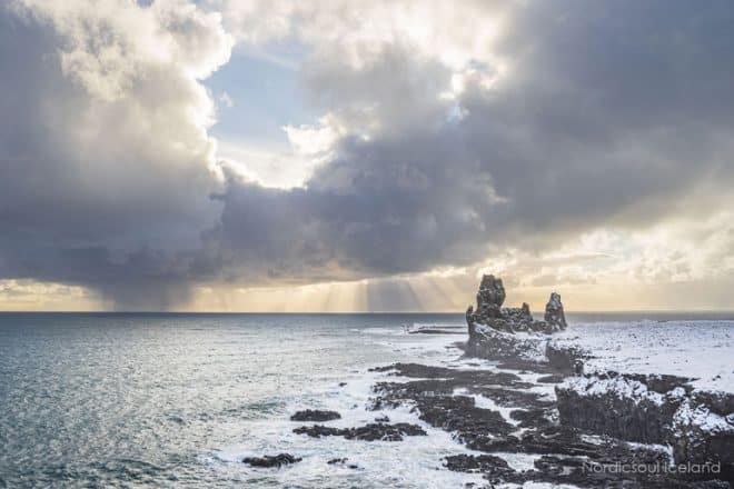
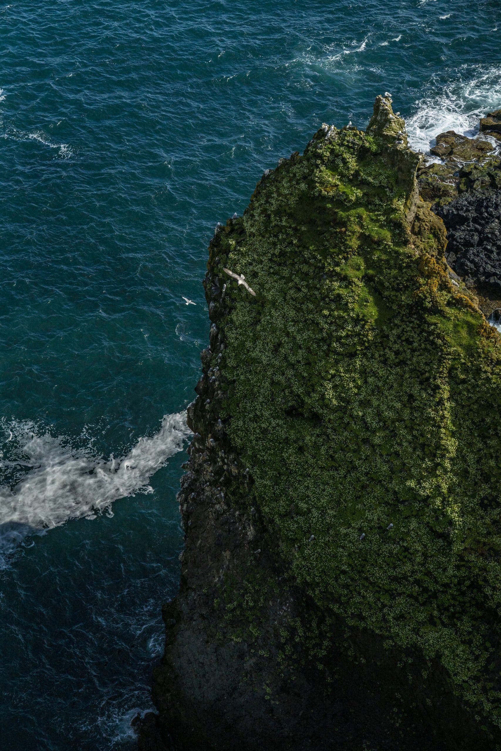
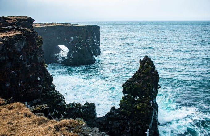
Lóndrangar Rock Stacks / Svalþúfa Hill
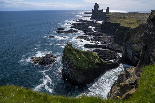
Lóndrangar (Lagoon Pinnacles) refers to two basalt pillars, 75 and 61 m (246 and 200 ft) tall respectively, that stand a short distance from the southern coastline of Snæfellsnes.
According to geologists, Lóndrangar are the remnants of an ancient crater that has steadily eroded with seawater over the centuries. This crater was thought to have emerged during an eruption at Snæfellsjökull volcano over 700, 000 years ago.
The sea stacks are best viewed from Svalþúfa Hill, only a short drive from Djúpalónssandur black beach. Viewing platforms were constructed here in 2014 to provide photographers and sightseers the perfect vantage point over the surrounding coastlines.
There is a large, cairn monument on Svalþúfa Hill to the legendary Bárður Snæfellsás, who according to folklore, was the protector of the peninsula. To this day, his spirit is still said to reside among the highest peaks of Snæfellsjökull.
The site is beloved by twitchers who make a stop solely to witness the many nesting bird species present there. Common Murre, Atlantic Puffins, Black-Legged Kittiwakes and Northern Fulmar can all be reliably spotted here during the summer months.
The Lóndrangar pillars are 199 kilometres (124 mi) from Reykjavík—roughly, a two-and-a-half hour drive.
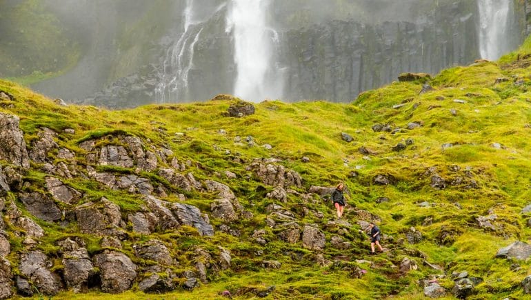
Bjarnarfoss Waterfall
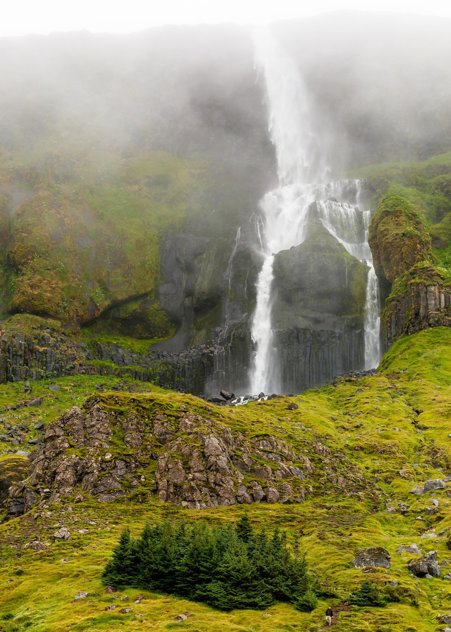
The lovely Bjarnarfoss (Bjarni’s Waterfall) can be observed directly from the road, but those seeking best views will want to climb the cliff sides beside it—not recommended during the winter, mind.
According to legend, the cascade is named after a local farmer, Bjarni, a wealthy but mean man who went crazy and threw all of his money into the waterfall
Bjarnarfoss is a relatively narrow cascade, dropping vertically at first, before trickling down over a wall of basalt columns. The fall measures a total of 80 metres (262 ft), outshining even the most famous waterfalls on the South Coast.
With that said, its thin stream of water does come with some drawbacks. During particularly strong winds, the waterfall is known to disappear altogether.
Bjarnarfoss can be found around 177 (110 mi) kilometres from Reykjavik.
Bjarnarhöfn Shark Museum
Bjarnarhöfn Shark Museum is the only establishment in Iceland dedicated to this country’s shark fishing industry. Greenland shark, or Hákarl, is the prize in these cold, Arctic waters, and has been a staple of the Icelanders’ diet for centuries.
With that said, this particular species of fish is poisonous when consumed fresh due to high concentrations of urea and trimethylamine oxide. To make it safe for consumption, the meat must first be fermented.
Traditionally, this process involves beheading and gutting the shark, before burying it in a shallow, gravelly grave.
Large rocks are then placed on top, draining the shark of any fluids. After six to twelve weeks, the shark is dug up, cut into strips, then hung out to dry throughout the town.
The modern method for processing Hákarl differs somewhat. Today, burying the shark in the ground has been replaced by pressing it between two sheets of grated plastic, thus draining the fluid quicker.
Fear not, however, as the traditional fermentation methods can still be witnessed at Bjarnarhöfn Shark Museum.
The family behind Bjarnarhöfn have been processing Greenland sharks on the peninsula since as far back as 1668. To this day, the museum is the largest provider of Hákarl in the Snæfellsnes region.
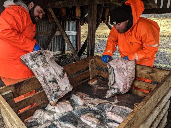
Which brings up another point. For anyone daring enough to taste-test this traditional sample from Icelandic cuisine, the museum serves as the optimum setting.
It is served in a perfect cube on the end of a toothpick, often with a side of Brennivín schnapps. Hákarl has a powerful fishy scent, and is dense with ammonia, immediately rendering the diner compelled to retch and reach for the nearest bucket.
Many compare Hákarl to both smelling and tasting like cleaning products or—pardon me, here—fresh urine. Of course, the only way to know is to sample it yourself—no doubt, you cannot wait for the opportunity!
On a personal note; I have yet to find a single person, Icelander or guest, who finds Hákarl tasty. After years of living in Iceland, I have not as of yet mustered the courage to sample it myself.
While in the Bjarnarhöfn area, guests would do well to visit the museum’s nearby lava field, Berserkjahraun, which lies under the foot of Bjarnarhafnarfjall mountain.
Rich with birdlife and strange, yet colourful rock formations, this area is mentioned far back in Iceland’s history, notably in the manuscripts, Eyrbyggja’s Saga and Heiðarvíga’s Saga.
Bjarnarhöfn Shark Museum is located 163 kilometres (101 mi) from Iceland’s capital, Reykjavík.
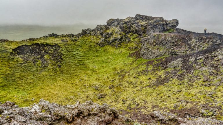
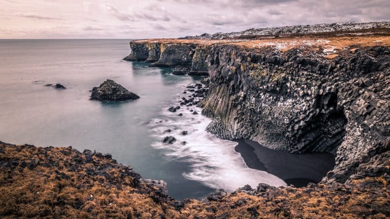
Djúpalónssandur Black Beach

Djúpalónssandur (Deep Lagoon Sands) is so much more than a black shoreline, but in fact, possesses some of the most fascinating lava formations on the entire peninsula.
Wandering among these peculiar pillars of rock, guests will no doubt stumble across the picturesque Svörtulón (Black Lagoon), as well as the peculiar rock formation of Gatklettur (Hole Rock). On sunny days, you can see Snæfellsjökull glacier through the opening in the rock, making it the perfect frame for photographing the glacier.
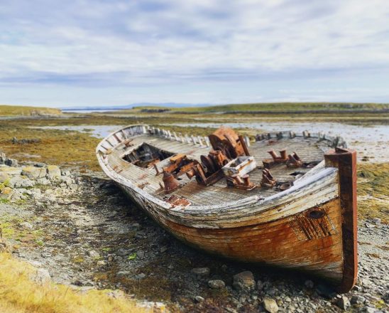
Down on the shoreline, visitors will also discover the remnants of a British trawler, Epine GY 7 from Grimsby. The pieces of this wreckage should not be touched, as they remain as a makeshift monument to the seamen who lost their lives when the trawler wrecked there on March 13, 1948.

Also on the beach are the famous Aflraunasteinar (Lifting Stones), four different sized rocks that were historically used by fishermen as a test of strength.
You can try to lift these yourself during your visit; if anything, it will make sure you appreciate the sheer hardiness needed for a life spent fishing at sea.
According to Icelandic folklore, Djúpalónssandur is a notoriously popular spot for the island’s trolls and elves. Some residents still claim that rock pillars that exist there are little more than the petrified bodies of these mythical residents.
Djúpalónssandur is 206 kilometres (128 mi) from Reykjavík.
Saxhólar Crater
A rusting metal staircase circles Saxhólar crater, allowing guests an easy climb right up to its lip where stunning views over the peninsula await.
Aside from the natural beauty of the site, the staircase itself is something of a phenomenon, having been awarded the Rosa Barba International Landscape Prize in 2018.
- Don’t skip out on these great Self-Drive Tours in Iceland
The crater is believed to have been the centerpoint of an eruption that took place around 3000 years ago. The surrounding lava fields are another consequence of this powerful event, adding a true and tangible depth of history to the site.
Given that Saxholar can be reached just off of Road 574, the crater makes for an excellent 10-minute stop on your journey around Snæfellsnes.
It can be found approximately 216 kilometres (134 mi) from Reykjavík.
Towns in Snæfellsnes
Aside from its many beautiful natural attractions, Snæfellsnes boasts a wonderful community culture thanks to its spattering out charming towns and villages.
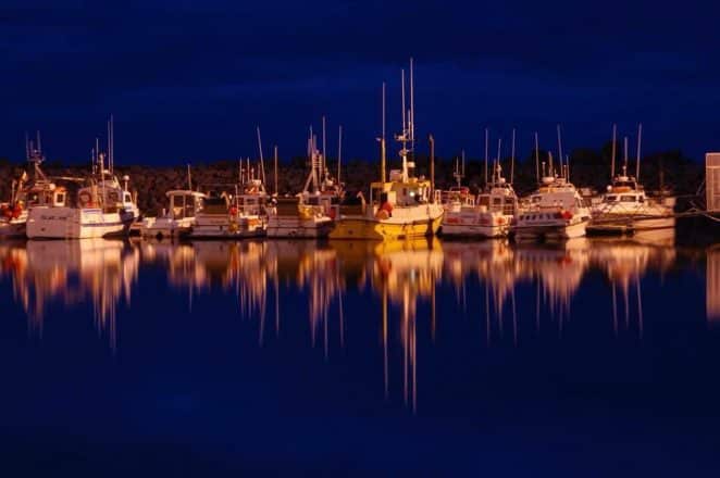
As with most settlements in Iceland, the peninsula’s residents live on the coast due to their rich history of fishing. This is still one of the primary industries on Snæfellsnes today, though it is swiftly being challenged by tourism.
As such, accommodation, restaurants and petrol stations can all be accessed either in, or nearby, to each town and village listed.
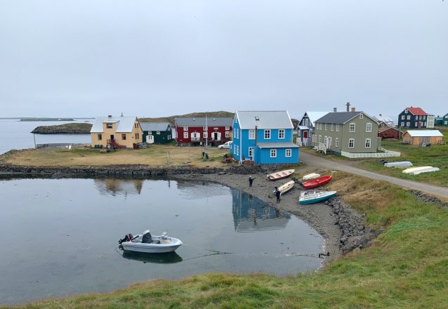
Stykkishólmur
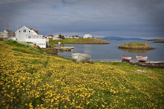
Charming in its cultural simplicity, Stykkishólmur is one of the peninsula’s larger towns, home to around 1200 people. It takes its name from a small island, Stykkið (The Piece), that can be seen overlooking the town’s harbour.
Located in the east of the region, Stykkishólmur has long served as an important centre of commerce.
The first trading post was established there in the mid-16th century, and was considered an especially crucial port during the Danish–Icelandic Trade Monopoly (1602 – 1787).
Every other year, on the third weekend of June, Stykkishólmur residents celebrate a festival named Danskir dagar (Danish days) to commemorate the town’s historic ties with Denmark.
As mentioned previously, the town is home to the Roni Horn’s Library of Water installation, as well as the island’s first ever two-storey residence, a jet-black home known as ‘The Norwegian House’ that today serves as a local museum.
Stykkishólmur is located 172 kilometres (107 mi) from Reykjavík.
Library of Water – Art Installation
The Library of Water is a highly artistic and sophisticated long-term project conceived of by the American visual artist, Roni Horn.
Housed in a former library in Stykkishólmur town, this captivating exhibition is split into varying parts.
The first sees 24 glass columns, each filled with meltwater from different glaciers in Iceland.
As light moves through these columns, the floor becomes filled with projected words, both in Icelandic and English, and all related to the island’s notoriously unpredictable weather.
Another section of the Library of Water explores audio recordings of the weather, as well as the observations of local Snæfellsnes residents.
In this way, guests should consider Horn’s vision as an essential part of getting to know the character of both Stykkishólmur and Snæfellsnes as a whole.
The Library of Water manages to be both emotive and informative, a feast for the senses dedicated, in part, to Iceland’s fascinating geology, geography, culture and climate.
Take the Baldur Ferry to Flatey Island
Visitors will need to visit Stykkishólmur if they hope to take the Baldur Ferry to the Westfjords. The midway-point of this journey across Breiðafjörður Bay is Flatey Island, a wonderful place to visit in its own right.
Flatey is about as isolated an island as one can get in Iceland. Home to only two families throughout the year, this tiny speck of evenly-levelled land was once an important trading and cultural hub for the Icelandic nation.
- Learn all there is to know about this hidden gem in our travel blog What to See and Do on a Visit to Flatey Island
Marking the highest-point on the island, Flatey’s most distinguishing landmark is its plain white church. The interior is more dramatic than its modest outdoors, with its wall decorated with large paintings that showcase Flatey’s historic residents at work.
These murals were painted by the Catalan artist, Baltasar Sampar, the father of one of Iceland’s most famous film directors, Baltasar Kormákur.
This familial relationship might be the reason why many believe the church’s depiction of Jesus Christ eerily resembles that of the filmmaker. We’ll leave that up to you.
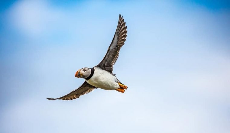
During the summer, the island is known for attracting thousands of Atlantic Puffins. These gorgeous, tuxedo-wearing birds can be seen waddling alongside other species like skuas and Arctic terns.
There is a small bar on the island, The Salt Cellar, which serves up their own take on the mojito—the Flahito, of course—as well as accommodation and food at Hotel Flatey. There is also a campsite on the island for summer guests, and a library, but note that there is no shop on the island.
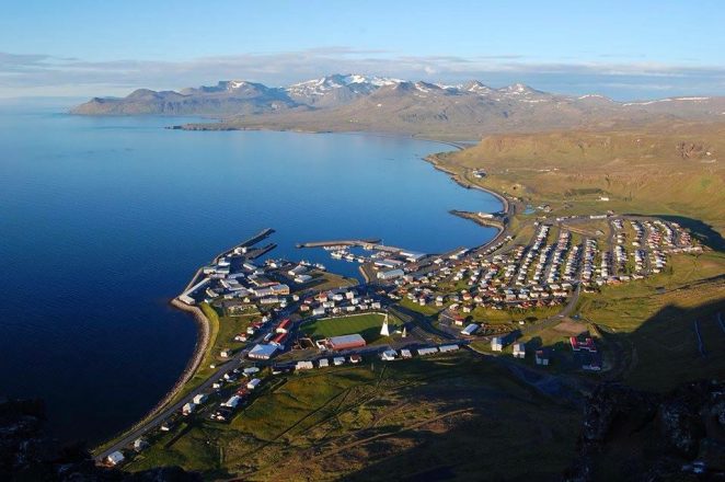
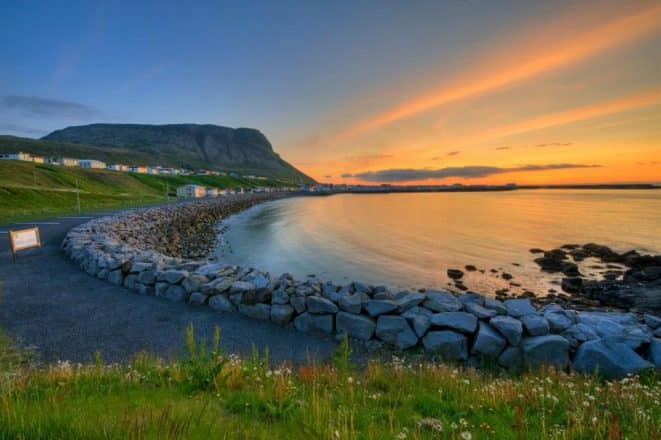
Grundarfjörður
With a population of little over 900 people, Grundarfjörður is best known as the small town that lies in the spectacular shadow of Kirkjufell mountain.
The town also makes for an excellent departure point for deep sea fishing and puffin tours, as well as exciting whale watching excursions.
There are a variety of guesthouses, hostels and hotels that make the town a pleasant stopover for travellers looking to spend a few days exploring the peninsula. There is also a campsite, open only during the summer, for guests looking to rough it in beautiful surroundings.
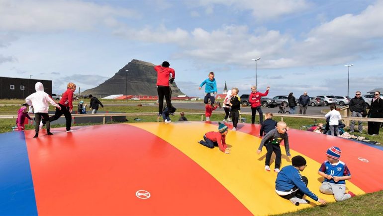
In July each year, the town’s residents celebrate Á góðri stund (Good Times), a festival that sees live music, bubble-fights and houses decorated in a wide array of vibrant colours.
It is tradition that participants dress equally colourfully, all of which culminates in making Grundarfjörður one of the happiest summer spots in the country.
To reach Grundarfjörður from Reykjavík, you will need to drive 176 kilometres (109 mi), a journey that will take roughly 2 hours and 20 minutes.
Ólafsvík
Ólafsvík, a fishing town located on the northwest of the Snæfellsnes Peninsula and has a population of approximately 1100 people.
Historically, Ólafsvík was one of Iceland’s largest trading ports, with commercial vessels routinely travelling between the town and Denmark throughout the 17th and 18th centuries. In fact, it was the first town in Iceland to be granted a trading license by the Danish King.
Accommodation choices in the town are plentiful. Of particular note are Hotel Ólafsvík, which offers luxury and modern amenities, or Lýsuhóll Community Center, which better suits travellers hoping to camp in sleeping bags.
Ólafsvík is nearby to Bæjarfoss waterfall, and lies right on the border of Snæfellsjökull National Park. The town is 195 kilometres (121 mi) from Reykjavík.
Arnarstapi
On the southern side of the peninsula lies the miniscule, but picturesque village of Arnarstapi (sometimes shortened to Stapi).
Like other Snæfellsnes towns, Arnarstapi was once operated as a trading port by the Danish Crown, its location chosen due to its easily-accessible harbour.
Over the last century, the population has diminished considerably, and is now mainly utilised as refuelling stop by travellers just before entering Snæfellsjökull National Park.
Between Arnarstapi and Hellnar lies a popular hiking trail that crosses the Hellnahraun lava field, famous not only for its epic rock formations, but also staggering coastal views.
Arnarstapi is 192 kilometres (119 mi) from the Icelandic capital, Reykjavík.
Hellnar
In today’s age, Hellnar is little more than a small cluster of a few buildings, and a small, red-roofed church. However, it was once a major fishing port, first mentioned by medieval sources in 1560.
It thought the town was built up a number of surrounding farmsteads, contributing to its population and commerce. For a time, the town’s harbour was the busiest on the whole peninsula.
Down by Hellnar’s shoreline, visitors will discover a number of interesting sites. Valasnös cliffside is particularly dramatic, sweeping wide and tall over the ocean, while Baðstofa rock formation perfectly encapsulates how erosion has sculpted this peninsula over the centuries.
North of the village, guests can also stop at Bárðarlaug, a beautiful crater lake reminiscent of the far-more known Kerið crater, which is often an added extra on Golden Circle sightseeing tours.
Hellnar can be located on the peninsula’s southern side, 195 kilometres (121 mi) from Reykjavík.
Rif & Hellissandur
Rif and Hellissandur are both tiny villages located on the northwestern tip of the Snæfellsnes Peninsula.
Rif was once much larger, serving as another important trading hub, but a deadly wave of smallpox in the 1600s diminished the population drastically.
The population decline was exasperated in the coming centuries by residents leaving their rural home to find opportunities in more industrial urban environments.
This trend was as true for Rif as it was Hellissandur, or any other of the small towns and villages located across Iceland. Some would argue that the same issue still faces such settlements today.
In modern times, Hellissandur has become best known for its informative maritime museum, a large section of which is dedicated solely to the fishing industry on Snæfellsnes.
At Hellissandur, there is also a campsite, restaurant and accommodation, making it a suitable stopover for those staying on the peninsula overnight.
Between these two small fishing villages lies one of the largest nesting colonies for Arctic Terns in Iceland. As such, it makes for a fantastic spot for birdwatching, and should be considered an essential visit for devoted wildlife enthusiasts.
Both villages can be found on the north side of Snæfellsnes, around 195 kilometres from Reykjavík.
What are the Best Activities to do in Snæfellsnes?
As previously mentioned, there are a wide variety of tours and excursions that guests can take part in while travelling in the Snaefellsnes Peninsula.
Aside from the obvious sightseeing routes and scenic stops, opportunities lie in wait for those looking to experience true adventure.
This might come in the form of kayaking around the picturesque islands off Stykkishólmur, or setting off on a thrilling whale watching expedition.
- Looking for the most fun activities in Iceland? Don’t miss our feature article The Top 14 Things To Do In Iceland
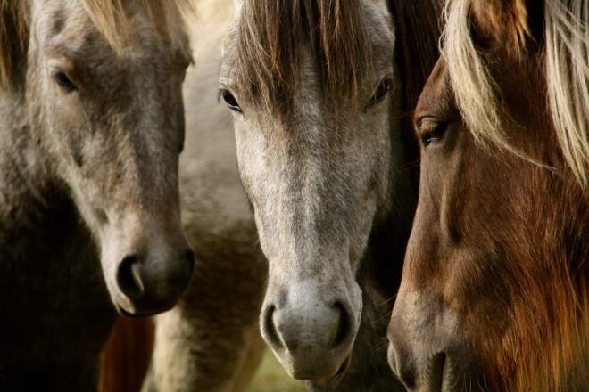
Others might choose to hike the dramatic glacial slopes of Snæfellsjökull glacier, which promises staggering views over the entire peninsula, or instead, take to the saddle for a lovely horse ride through the countryside.
If you are looking for fun-filled activities on Snæfellsnes, feel free to contact us at Traveo and we will be more than happy to recommend and book an activity for you.

There are also some exciting festivals that take place throughout the year; one of the most thrilling being the Northern Wave International Short Film Festival, which has been growing steadily since having first been founded in 2007.
The festival was held in Grundarfjörður town until 2016, after which it moved to Rif. The event is based around the philosophy of Nouvelle Vague, with one of its main aims being to the reclaim filmmaking as an artform
Previous honorary guests have included four-time Oscar winner, Marc Berger, as well as a host of Icelandic actors, cinematographers and directors. The festival will next be taking place 23rd – 25th of October 2020.
The End of our Journey around Snæfellsnes Peninsula
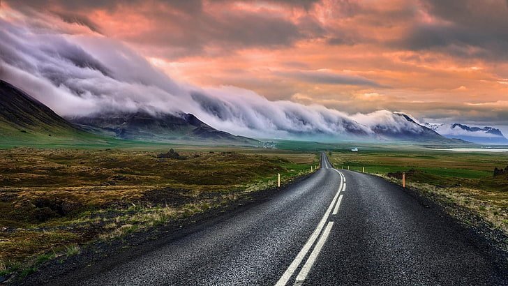
Travelling West Iceland’s Snæfellsnes Peninsula brings sights of canyons and volcanic meadows, sable shorelines and polar mountain peaks, all under the Northern Lights in winter, or Midnight Sun in summer.
Visitors here can taste the area’s unique cuisine, stop by its quaint seaside towns, and learn its fascinating history. Spending a night or two on Snæfellsnes is an easy affair, with readily available accommodation found in its small towns and villages.
But travelling vicariously will only get you so far. Which, of course, leaves only one step; experiencing this unforgettable landscape for yourself.
Make sure to check out our wide variety of tours and excursions so that you too can experience the magic, awe and adventure that Snæfellsnes has to offer.